My Girl: Gettin' After It!!

My Girl: Gettin' After It!!
My truck on her maiden voyage in Moab 2012

Saturday, December 28, 2013

Second Mountain Trail- GWNF 12-28-13- Solo Scout Expedition

I went ahead to scout additional trailhead locations down near Harrisonburg in the GWNF as alternatives in case something goes down with the Kennedy Ridge plan for the 18th. Dictum Ridge is another trail with a common trail head. I had hoped to try that one out too, but I had a late start and a bit of misdirection from a 'local' that caused me to be somewhere I probably shouldn't have been and thus I just needed to leave. In any event, I'll detail the expedition via photos and such as per usual.

Obviously staged.
 I was legitimately reviewing printouts of trail maps and excerpted posts from Jeep Forum and Dirtopia to make sure I had my bearings. When I set out in the morning, I only recalled that I needed to get to Rt 33 in Harrisonburg. And I've been there many times; so, when I finally roused myself and had the truck loaded, away I went. This was my first study of the area since I first researched updated trail info on or around the 12/19.

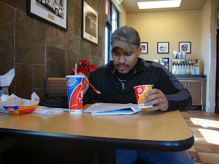
I finally got to try the $5 Buck Lunch at DQ though.

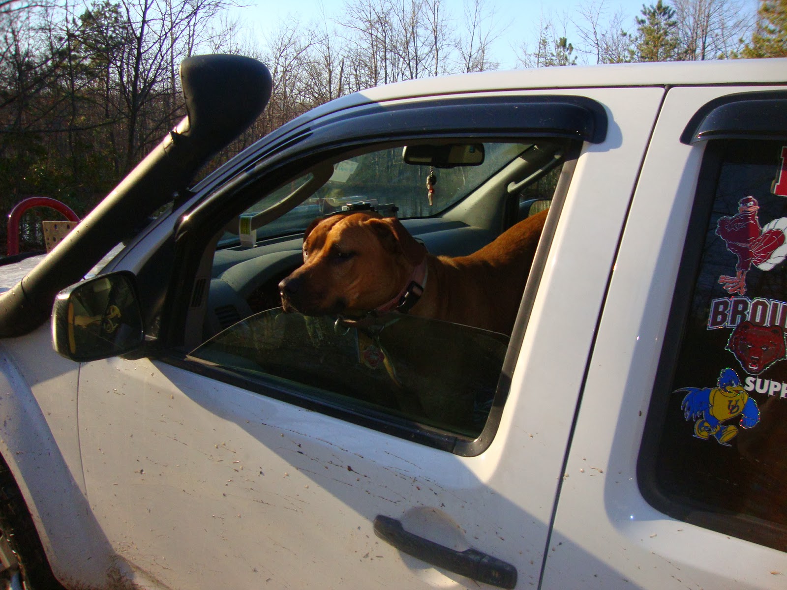
Some of the last surviving footage of my new HAM antenna.
 As you may have guessed from the limited foreshadowing and obvious caption, I got a new antenna roughed in last night and promptly lost it today on the trail. The overhanging branches and brush were not that bad. I've traveled through far worse up at Rock Run with Steve and Cruzer...that damn Trail 2 still pisses me off. Anyway. I had even intended to mount a second bracket to which to attach the antenna when it folded down. It has/had the capability of folding down. Well, I didn't fold it down and when I got back into town, it was gone. $120 down the drain. My lesson learned is that I will leave the special quad band antenna - that I must now reorder - in the folded down position unless actively transmitting from a stationary position. For listening to repeaters and such, I should mount a dedicated dual band 2m/70cm antenna to the front bumper and feed the antenna into the cab. I can then hook that up to my little BaoFeng handy-talky and just leave that in the cupholder to monitor any local repeater action.

I primarily took this photo though to highlight how the truck is starting to finally come along and distinguish itself from it's other mid-size brethren. Here, I'm dwarfing a Ford Ranger which is sitting on a set of respectable tires (Cooper Discoverer S/Ts).
 I was very glad to see this sign.

From Harrisonburg, it is exactly 10 miles from the Royal Farm where I gassed up to the right hand turn for Rt 612 which was per the Dirtopia directions. That road is called Peake Mountain Road. The directions didn't mention, but I made notes that there are a total of two (2) left hand turns to stay on 612 which occur after 1.5 and 4.5 miles of travel (or the 11.5 and 14.5 mile marks if you set your trip odometer from the Royal Farm). From there keep an eye out for Gospel Hill Church; immediately thereafter is your Left turn, seen above.
 This is the single track road and switchbacks that make up Long Run Rd.
 It is slow going. Although the road looks to be relatively flat, I was still riding at highway tire pressure and there are sudden bumps and dips that can be quite jarring. Maybe my front shocks are signalling that they've given up the ghost, but I found it to be deceptively rough for what appears to be a smooth, hard-packed road. I did notice; however, that the gentleman who pulled in behind me was taking the road at significantly lower speed than I was.
 Although it is only another 5 miles up the mountain, it seemed to take an inordinate amount of time to get here. You can't really open it up on the road as there are numerous blind turns and the track is not particularly wide between steep rock outcroppings to the left and a precipitous drop to the right. I passed several parties handling dogs up through these woods. They looked at me with a lot of suspicion. The truck and I do have a way of standing out a bit. She was still, at this point, pretty shiny from the last bout of warm weather when I took the opportunity for  rare, mid-winter wash in the driveway.
 So I got out to take photos of the various paths one could take to remember for posterity and to post in this blog. The one guy first asks me what I'm doing.

"Ya like taking pictures?"
"Well, I'm kinda scouting the trail and want to record where I've been."
"There's some  beautiful scenery down yonder," and he commences to describe the path to be taken. It's a bit out of the way, but it was a nice gesture. I kinda thought, here are two men in the middle of the woods, from different walks of life, talking about skylines and sunsets together.
 But then he made me nervous. I had started airing down at this point not knowing whether I'd get another viable opportunity where I wouldn't obstruct any other traffic on the trail. The guy gets out of his truck, walks towards Veronica and says to me,

"I'd like to have your truck..."

At that moment, another truck pulls up. The blue truck in the picture above was the guy who took the trail behind me. He was only in the shot momentarily.

Anyway, I'm thinking, 'Ain't nobody just gonna roll up in the middle of the woods and take my truck.'

So I remark about how solid the Toyotas are, and that mine is still a work in progress. We got into talking about the hilux and the reputation for it in other countries. This is mostly me talking.  Fortunately, it was just an in-artful way of paying my truck a compliment, but I wasn't sure how to take it.

Anyway, the other truck had picked up this guys dog. All the dogs were wearing radio transmitters and were scattered all over the mountain chasing some sort of game. And the various guys were collecting the dogs from varying points. Still not sure what exactly they were doing, but that's what I gathered from the chatter I could hear on their CBs as they were near me. We weren't on the same channel. I was tempted to scan around to listen in on whether they were talking about me at all. It's doubtful though. I had, at least at that point, 3 aftermarket antennas not including the stock antenna (totaling 4). I could damn near talk to the space shuttle had I not let my good antenna get clipped. Oh well.

 From this clearing, you take the trail to the left 422 which is marked with a tombstone/wood pillar labeled Dictum Ridge. This serves as the trailhead access road to the trail head and where 2nd Mountain Trail and Dictum Ridge converge at their northernmost points..
 I got a little confused here. If you see these signs, you are somewhere you're not supposed to be.
The reviews said to head to the left from the trailhead. To add a little more detail, you need to head to the left as you EXIT the trailhead, not as you enter. Fortunately I just checked these on foot. The guy who passed me was bringing in his dirtbike and he was familiar with the area. He had said he didn't know what this trail was but thought it was closed. He pointed me in the right direction on how to get onto 2nd Mountain.

 Away we go.
 Pretty cool overlook along the powerline ridge. Several times, the trail will look like it is meant to converge and lead you along these paths. It is not intended for you to do this. After the first two instances of thinking I might have made a wrong turn, I was always confirmed as correct by bypassing the occasional diversions which appear to lead you along the power lines.


 This might be my favorite time of year to tackle green trails. I really like frozen water puddles for some reason. It's like a slip and slide for big kids.

 This is how mountains are made. Huge displacements of the earth's crust or something geologic. Tectonic. I dunno.
 Posed my truck near them. Staying on the trail, of course.

 So. I read that there would be a gate at the end of the trail and that it is closed. Well, the gate was open and a truck was making his way up. I asked him if it was private property. He assured me it was not and that he had come up that way from the main road. I get all the way down there planning on returning back. Well at the very end, there is a sign visible to traffic coming in the opposite direction stating that these are the Rawley Pike private estates. The roads leading from either side of it all said "Private Property" and "No trespassing" which is typical of these trails as the roads are public rights of way through private land. However, going through either one of the two last gates takes the unknowing, and ill-advised traveler into private property. I had wanted to run the trails in reverse, but seeing as how my misdirection could be interpreted as trespassing, I thought it prudent to leave the area immediately.

So I was really bummed by that because much of the trail was downhill and I wanted to run some of the muddier, icier sections in reverse.

It really is a shame that the 'entrance' on the south side is not public. It is very prompt access to the trail versus the long, meandering switchbacks that are required via Long Run Rd.

The other thing I was able to confirm is that it did not appear possible for a full-sized vehicle to even attempt the 1.4 mile ATV section that connects 2nd Mountain Trail and Dictum Ridge at the south ends, as I recalled seeing almost bollard-like structures erected at an area posted with a sign reading "Only Experienced ATV riders should take this trail".
 Jenn and I got married in this area. I went to the same bar/restaurant where I hosted our rehearsal dinner. Steve would like this place. They've greatly expanded their craft brew selection since we were last here. And they have plenty more selections by bottle that I didn't even begin to get into. I snapped some pictures of the menu which I had intended to upload. But I'm kind of in a race against time to head out somewhere to watch UFC 168. I was a big Rousey fan, but I found myself a bit turned off by her behavior on TUF. Like I get that you don't like Tate, but this isn't a grade school playground. Turn it down like 4 notches. Anyway, I want to see that.
Although I think it is weird when people take pictures of their food (food is for eating), I took one of this so I can emulate Steve's old blog. I ordered the Stuffed Pretzel, which has several split kielbasa and some sweet mustard sauce between two pretzel rolls. I had an Apocalypse Glorious Dead and I forgot what my first beer was. I looked on my phone. Blue Mountain Dark Hollow Stout.

Hopefully I can have some friends. And some friends can come out and play.

The truck handled well though. I had emergency comms. I had the best compliment of recovery gear with me to date. And I packed as if I was going on an arctic expedition with full camping gear and several winter rated layers...for a trip lasting only a few hours. But the idea was that should some unfortunate circumstances befall me where i was not completely incapacitated and could rouse myself, I could hunker down until rescue came. I didn't really believe it would come to that. The reviews stated that the trails were not exceptionally difficult. And the guy on the motocross bike was also traversing alone. As was the 'wrong way' guy that almost caused me to trespass. Anyway. I'm looking forward to more adventures WITH accompaniment. Until next time.

-will

Tuesday, December 17, 2013

33s and the Coolant Scare of 2013

These waning days of 2013 have been stressful. I have a project that will take an act of congress to close out, my tires were wearing down on the eve of predicted snow storm and just prior to an offroad event in Ohio, and my truck was loosing significant amounts of coolant...daily. Oh, and my light still aren't wired up.

It goes on and on. But I was not the happiest of campers.

I took the truck to the dealership on a Wednesday, I think, and they were less than thorough in evaluating my issue. To them, it appeared the coolant was leaking from near the rear of the engine, and in addition to the diagnostic fee of between $120-150 already assessed, they estimated another 4-5 hours would be needed to permit them to drop my exhaust manifold so they could get a closer look...to the tune of about another $530. I stated I couldn't be out of work that long and would have to reschedule to return. Meanwhile, I ordered some new tires...in 285/75/16 and they arrived Friday after work. I resolved that with the supposed snow storm coming (the third that ultimately didn't do much in my area but pretty reasonably pummeled locations further north and west) and the potential damage to the engine, it was sufficient cause to forego the Southington Offroad event. I was bummed, but it was the right decision.

Instead, I took my truck to Midas. They actually performed the pressure test that the service adviser at the dealership suggested might be needed. Not sure if it was performed at the dealership as the tech left for lunch without transcribing any notes or telling the service adviser or the shop manager anything about my truck. They simply handed me my keys, invited me to wait on this dude or just call back if I had questions. We cannot go back there again. Anyway, Midas did the thing, found the hose that was loose and resolved it. Thing is, it only really leaked when under pressure, and apparently it sprayed as opposed to trickling which is why I could never find a trail when looking from up above. Anyway, with the leak troubleshot they went and mounted the new tires.

I opted for Goodyear Wrangler Duratracs for both the aggressive, self-cleaning tread blocks and the fact the tires are rated for Severe Winter Service (as evidenced by the snowflake on the mountain symbol). This is in addition to the M+S rating, where the former actually involves physical testing of performance in winter conditions (so I've read).

Still no significant snow, but I'll have them when/if it comes.

I may opt to get some cheaper ATs for tooling around town and have these for the winter and offroading. For now they are my everyday tire and I hope they wear well.

I will need to revisit my efforts at trimming and performing the melt-mod to clear the wheel well liner from rubbing the tires on turns. The passenger side is good and clear. I do, on occasion still rub the driver's side. I've not yet been offroad to see whether or not the rubbing becomes more severe when one really gets rolling. I'm excited to see how the larger diameter tire aids in ground clearance and hooking up better with the terrain.

As always, a few pics to show the current state of the truck.

Looking through the shop window while Veronica gets her alignment.

Out on the blacktop.
A screen grab of the "WENTWindrock" enthusiast page. Veronica made the front page!
I almost forgot. While perusing facebook, I saw a link to the WentWindrock page that arose out of some conversations the organizers of NXM3 (National Xterra Meet) were having while I was down there in Tennessee. Well, lo and behold, my humble little Frontier made it onto the front of the homepage.

You can follow the URL here: WentWindrock

That's about all I've got for this update.

Saturday, November 30, 2013

GWNF- Scouting Peter's Mill OHV trail and Big Levels (Map 27) Forestry Roads

I need to do something about those cock-eyed lights. Either way, this was the first trail ride opportunity I had upon the completion of the new bumper. The lights aren't even wired up as I ran into some complications yesterday before heading over to see the 'rents for Thanksgiving.


 I decided kind of spur of the moment to head down to George Washington National Forest to check out some trails. It was last minute and with the holiday I knew there wouldn't really be any takers.


 My typical shot of the signs from behind the truck.

Steve set me up with some maps he found online a few months back.

I first had to drive past the area of the trail head to obtain an OHV permit. You can get here from Exit 6 off of 66 West. I had to double back to this exit. The closest place to pick up a permit was Cook's Exxon and service plaza on Reservoir Rd in Woodstock, Va. It was about 17-20 miles out of the way down to 81 and then back up 81 and onto 66.

There is a way to come in off of 81 that puts you at the bottom of the trail and across from the ATV area in Edinburg Gap. I chose to double back so that I could follow this trail down, then get on the highway and continue down to the Big Levels area.
 The directions from the USDA Forestry website were spot on. Had no problem making my way to the trail head.
 The signage was pretty straightforward. 433 was what I was looking for. This is the only trail rated for vehicles over 50" wide.


 Most seem to run it from the South from Edinburgh and head North. I encountered about 6 other vehicles on the trail, all heading North. The trail is only one vehicle wide, but there were several areas along the way where one could find clearance to allow a vehicle to pass headed the other direction.
 I thought this fire pit was kinda cool; so, i circled it and took a photo.
 After a few whoops and humps initially, the trail was pretty tame. I enjoy this time of year because of the freezes and thaws that can make an otherwise tame trail a bit more interesting. In this case, there were quite a few modest puddles and pools to splash through and get your truck a bit muddy.
 Pristine mountain lake. You could see right to the bottom. It wasn't very deep. I was tempted to do some submarine action, but I believe this would have been contrary to the direction to 'stay on the trail'. So I stayed on the trail and took a picture from the bank instead.


 I set up the self-timer. Key when travelling alone. In the other trucks and Jeeps that passed, there was only one vehicle in each party. There generally was at least one other occupant. It also happened to be hunting season. I had wanted to let Maddy loose in a few areas, but neither of us had any blaze orange. So she had to stay cooped up.
 There were sporadic rock outcroppings, but this was a legitimate little rock garden. Again, still stock-friendly, but challenging enough to make you take notice. I had been traveling between 7-10 mph on the easier sections. Well I took this portion a bit too fast. I got some nice air unexpectedly rebounding up off of a rock before crashing down...hard...on another one. I reduced my speed thereafter.
 I got to an interesting four-way fork in the road where both my map and this sign showed that only two trails should be converging into 433. So I just followed my offroad default and continued on the right-most trail. it worked.


 This was the winning direction at the crossroads
 I was driving into the sun most of the afternoon. I should have gotten an earlier start.


 Hairpin turn here to the left. Nice opening to check out the valley and the mountainside across the way.


 It felt a lot more off camber than it actually was. When I got out and framed the shot, it was actually a bit embarrassing. "Just get back in the truck".
 I made it through to the other side. I ended up driving closer to 8 miles than the stated 6. I think the first mile or so wasn't technically 433 yet. I got nervous when my trip miletracker started rolling into 8 or 9 miles with no sign of the highway.
 I thought this sign was funny. There were portions when I thought maybe a Honda Civic could do the trail. Then there were parts where one decidedly could not, unless you had no intent of driving it through to the other side in tact. Now I did the full thing in 4Hi. I never needed 4Lo. One probably could muscle through in 2WD the full way, but that approach is much harder on the trails. I didn't have anything to prove.
 So I didn't pay close attention to the maps (shocker). And I took for granted how far apart Edinburg Gap was from the Big Levels area. It is about an hour further south down 81 to end up south of Staunton. I knew it would be after dark before I got to that area. To complicate things, I didn't download enough of the maps to see the direct way from the North. So I drove further south to the bottom of the area and worked my way back up the various state roads to find the trailhead.

In retrospect, all one needs to do is take 64 East off of 81 for about 8-10 miles, then take Mt. Torrey Road over to where it intersects with Coal Rd. I ended up heading down 81 to a junction with Route 11, then making a left on 666 (scary...but actually pleasant. Not at all indicative of the mark of the beast). Take the right onto 608. The maps show it dead-ending but it actually just turns into someone's driveway. In the dark, it might be hard to make the distinction.

At this point though, the roads stopped being identified by their state number designations. I actually missed my intended turnoff onto 41 as it wasn't labeled as such on the sign or on my GPS. I realized I missed it when I came to a fork between continuing on 608 or running onto 667. I then deduced that the next road back after a Uturn would be my road. So you need to make that left onto St. Mary's if you come this way. Although I'm not sure why you would come this way unless you were coming from the South.

 This was purely guesswork. But when I saw that 42 I felt...hopeful. You can see how dark it was from the photo. And I had been driving for a long time to have to turn back at this point lost on the devil's road and such.
 I was on 42 for a while before I encountered this sign. Again I felt good as I saw on the Jeep forum that this area was called "Big Levels". I'm here.


 Took three different takes trying to get the right light setting.

 This is right before the trail. I thought this was going to be it. This was just a construction site. It was better marked than the actual trail.

The trail, surprisingly, showed up on my GPS...which is not showing up on my picture. This was helpful as there were two forks right before this section that I might otherwise have taken. Except I saw something about "Kennedy" on the forum and "Kennedy Ridge Trail" was showing up on my GPS. This turns out to be 162.


 I stopped to take a photo of the terrain changing a bit. This is the dust that was kicked up in the air showing up in the flash.
 I actually drove away from the trail...twice. And then I thought I  needed to go far enough in to get a flavor of it and see if it continues and gets more gnarly. It does. It rejected me twice. I got in and then wasn't sure I could get out. So I pressed on. Then  I saw a section where I would definitely need to do some winching. And in the pitch black, with random hunters driving around and walking around, I just didn't want to be there in the dark, alone and vulnerable. Call me a punk if you want. There's just no need to push the envelope to that extent when this trail is so close to home. I'm definitely coming back with some reinforcements. Each of the roads looks to be about 4 miles long. Between maneuvering the technical portions and then doubling back to access the other sections, a group could easily spend a day just on these three forestry roads. So I decided to call it a night and pull the ill 18 point turn to double back out.
 This is what sent me back. It doesn't look like much here, but the valley was about 3/4 deep as I am tall and then the next crest is well within my wheel base. If I didn't high center, then I would 'bridge' the valley and have all 4 wheels off the ground. I could see this happening. Or, because the valley is at an angle to the direction of travel, I could go off-camber and partially roll and lose traction. It would definitely be fun to cross, just not at night.
We will be back, weird, leaf-covered humps.

Anyway, there is a convenience store about 7 miles from this start point. This will be the rally point before heading down to this trail in January. Really looking forward to coming back to the area to tackle this and scout more of the forestry 'roads'.
We still need to get over to Trail Map 9 and finish that loop as well. That's the only remaining OHV 'trail'. But now I'm discovering that the 'roads' may have more challenges to offer than the trails.

This is my new mission. Chronicle the roads.