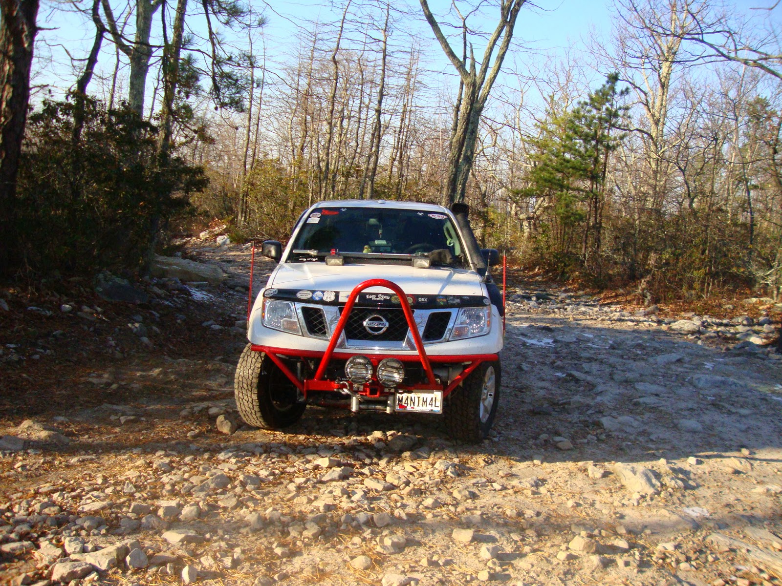
I need to do something about those cock-eyed lights. Either way, this was the first trail ride opportunity I had upon the completion of the new bumper. The lights aren't even wired up as I ran into some complications yesterday before heading over to see the 'rents for Thanksgiving.
I decided kind of spur of the moment to head down to George Washington National Forest to check out some trails. It was last minute and with the holiday I knew there wouldn't really be any takers.
My typical shot of the signs from behind the truck.
Steve set me up with some maps he found online a few months back.
I first had to drive past the area of the trail head to obtain an OHV permit. You can get here from Exit 6 off of 66 West. I had to double back to this exit. The closest place to pick up a permit was Cook's Exxon and service plaza on Reservoir Rd in Woodstock, Va. It was about 17-20 miles out of the way down to 81 and then back up 81 and onto 66.
There is a way to come in off of 81 that puts you at the bottom of the trail and across from the ATV area in Edinburg Gap. I chose to double back so that I could follow this trail down, then get on the highway and continue down to the Big Levels area.
The directions from the USDA Forestry website were spot on. Had no problem making my way to the trail head.
The signage was pretty straightforward. 433 was what I was looking for. This is the only trail rated for vehicles over 50" wide.
Most seem to run it from the South from Edinburgh and head North. I encountered about 6 other vehicles on the trail, all heading North. The trail is only one vehicle wide, but there were several areas along the way where one could find clearance to allow a vehicle to pass headed the other direction.
I thought this fire pit was kinda cool; so, i circled it and took a photo.
After a few whoops and humps initially, the trail was pretty tame. I enjoy this time of year because of the freezes and thaws that can make an otherwise tame trail a bit more interesting. In this case, there were quite a few modest puddles and pools to splash through and get your truck a bit muddy.
Pristine mountain lake. You could see right to the bottom. It wasn't very deep. I was tempted to do some submarine action, but I believe this would have been contrary to the direction to 'stay on the trail'. So I stayed on the trail and took a picture from the bank instead.
I set up the self-timer. Key when travelling alone. In the other trucks and Jeeps that passed, there was only one vehicle in each party. There generally was at least one other occupant. It also happened to be hunting season. I had wanted to let Maddy loose in a few areas, but neither of us had any blaze orange. So she had to stay cooped up.
There were sporadic rock outcroppings, but this was a legitimate little rock garden. Again, still stock-friendly, but challenging enough to make you take notice. I had been traveling between 7-10 mph on the easier sections. Well I took this portion a bit too fast. I got some nice air unexpectedly rebounding up off of a rock before crashing down...hard...on another one. I reduced my speed thereafter.
I got to an interesting four-way fork in the road where both my map and this sign showed that only two trails should be converging into 433. So I just followed my offroad default and continued on the right-most trail. it worked.
This was the winning direction at the crossroads
I was driving into the sun most of the afternoon. I should have gotten an earlier start.
Hairpin turn here to the left. Nice opening to check out the valley and the mountainside across the way.
It felt a lot more off camber than it actually was. When I got out and framed the shot, it was actually a bit embarrassing. "Just get back in the truck".
I made it through to the other side. I ended up driving closer to 8 miles than the stated 6. I think the first mile or so wasn't technically 433 yet. I got nervous when my trip miletracker started rolling into 8 or 9 miles with no sign of the highway.
I thought this sign was funny. There were portions when I thought maybe a Honda Civic could do the trail. Then there were parts where one decidedly could not, unless you had no intent of driving it through to the other side in tact. Now I did the full thing in 4Hi. I never needed 4Lo. One probably could muscle through in 2WD the full way, but that approach is much harder on the trails. I didn't have anything to prove.
So I didn't pay close attention to the maps (shocker). And I took for granted how far apart Edinburg Gap was from the Big Levels area. It is about an hour further south down 81 to end up south of Staunton. I knew it would be after dark before I got to that area. To complicate things, I didn't download enough of the maps to see the direct way from the North. So I drove further south to the bottom of the area and worked my way back up the various state roads to find the trailhead.
In retrospect, all one needs to do is take 64 East off of 81 for about 8-10 miles, then take Mt. Torrey Road over to where it intersects with Coal Rd. I ended up heading down 81 to a junction with Route 11, then making a left on 666 (scary...but actually pleasant. Not at all indicative of the mark of the beast). Take the right onto 608. The maps show it dead-ending but it actually just turns into someone's driveway. In the dark, it might be hard to make the distinction.
At this point though, the roads stopped being identified by their state number designations. I actually missed my intended turnoff onto 41 as it wasn't labeled as such on the sign or on my GPS. I realized I missed it when I came to a fork between continuing on 608 or running onto 667. I then deduced that the next road back after a Uturn would be my road. So you need to make that left onto St. Mary's if you come this way. Although I'm not sure why you would come this way unless you were coming from the South.
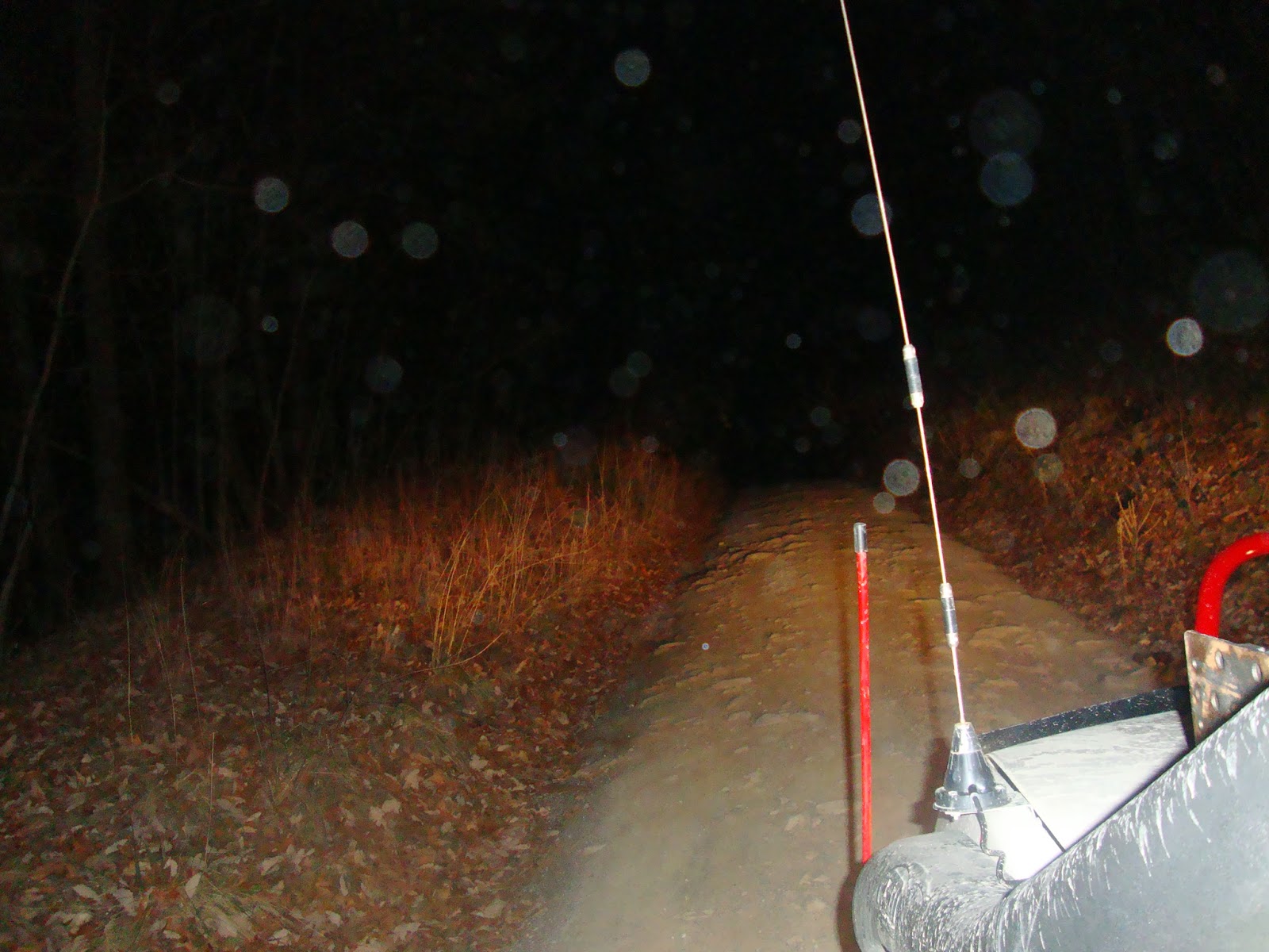
This was purely guesswork. But when I saw that 42 I felt...hopeful. You can see how dark it was from the photo. And I had been driving for a long time to have to turn back at this point lost on the devil's road and such.
I was on 42 for a while before I encountered this sign. Again I felt good as I saw on the Jeep forum that this area was called "Big Levels". I'm here.
Took three different takes trying to get the right light setting.
This is right before the trail. I thought this was going to be it. This was just a construction site. It was better marked than the actual trail.
The trail, surprisingly, showed up on my GPS...which is not showing up on my picture. This was helpful as there were two forks right before this section that I might otherwise have taken. Except I saw something about "Kennedy" on the forum and "Kennedy Ridge Trail" was showing up on my GPS. This turns out to be 162.
I stopped to take a photo of the terrain changing a bit. This is the dust that was kicked up in the air showing up in the flash.

I actually drove away from the trail...twice. And then I thought I needed to go far enough in to get a flavor of it and see if it continues and gets more gnarly. It does. It rejected me twice. I got in and then wasn't sure I could get out. So I pressed on. Then I saw a section where I would definitely need to do some winching. And in the pitch black, with random hunters driving around and walking around, I just didn't want to be there in the dark, alone and vulnerable. Call me a punk if you want. There's just no need to push the envelope to that extent when this trail is so close to home. I'm definitely coming back with some reinforcements. Each of the roads looks to be about 4 miles long. Between maneuvering the technical portions and then doubling back to access the other sections, a group could easily spend a day just on these three forestry roads. So I decided to call it a night and pull the ill 18 point turn to double back out.

This is what sent me back. It doesn't look like much here, but the valley was about 3/4 deep as I am tall and then the next crest is well within my wheel base. If I didn't high center, then I would 'bridge' the valley and have all 4 wheels off the ground. I could see this happening. Or, because the valley is at an angle to the direction of travel, I could go off-camber and partially roll and lose traction. It would definitely be fun to cross, just not at night.
We will be back, weird, leaf-covered humps.
Anyway, there is a convenience store about 7 miles from this start point. This will be the rally point before heading down to this trail in January. Really looking forward to coming back to the area to tackle this and scout more of the forestry 'roads'.
We still need to get over to Trail Map 9 and finish that loop as well. That's the only remaining OHV 'trail'. But now I'm discovering that the 'roads' may have more challenges to offer than the trails.
This is my new mission. Chronicle the roads.


No comments:
Post a Comment
Hey! Let me know what you thought of the post or how you came to stumble on this little corner of what we call, "the interwebs". Thanks for stopping by and leaving a comment.
-will